Exact coordinates, whether taken from a GPS finder or from a map, are of great help to us. After the alarm has been raised, our Operations Center passes on the coordinates to the helicopter crew, who, with the aid of a navigation device, are then able to fly to the precise site of the accident. As a result, complex and time-consuming search operations can be avoided. Therefore, in the event of an emergency, we are pleased if you can provide us with the exact GPS coordinates of the person in distress.
However, as is often the case, this is not quite as straightforward as it might sound: for example, after it is switched on, a GPS device usually takes a few minutes to display the exact position. You should also familiarise yourself beforehand with which buttons you need to push or which menu displays the relevant coordinates. Experience has shown that unfortunately many GPS users do not know exactly where they can find their coordinates in an emergency.
Moreover, in a stress situation - which is often the case when raising the alarm - it is only too easy to get a digit or the position of the comma wrong when giving the GPS coordinates. It is therefore extremely important to remain calm and to read off the exact coordinates, including the position of the comma and any spaces. It is best to set your GPS to the Swiss coordinate system, Swiss Grid, which delivers the information clearly and simply. We are also are able to take over this data direct without having to convert it.
One last tip: Never blindly rely on your GPS finder - at that all-important moment, the batteries might fail or it might break as a result of the accident. You should always also know and be able to describe your position without using your GPS, wherever possible giving the place names as shown on official Swiss maps. It is also recommended that you always take a detailed map with you when you go off on a hiking tour. And you should never be tempted to take greater risks - for example, in adverse weather - simply because you are carrying a GPS device.
Six tips on how to use your GPS device properly:
- Does it have sufficient battery power for the planned tour?
- Do I know how and where to find out the coordinates of my position at any given time?
- Is it switched to Swiss Grid?
- In stress situations, take care to read the data accurately!
- Do not take greater risks simply because you are carrying a GPS device!
- Even if you have a GPS device, always take a map with you (scale 1:50,000 or 1:25,000)
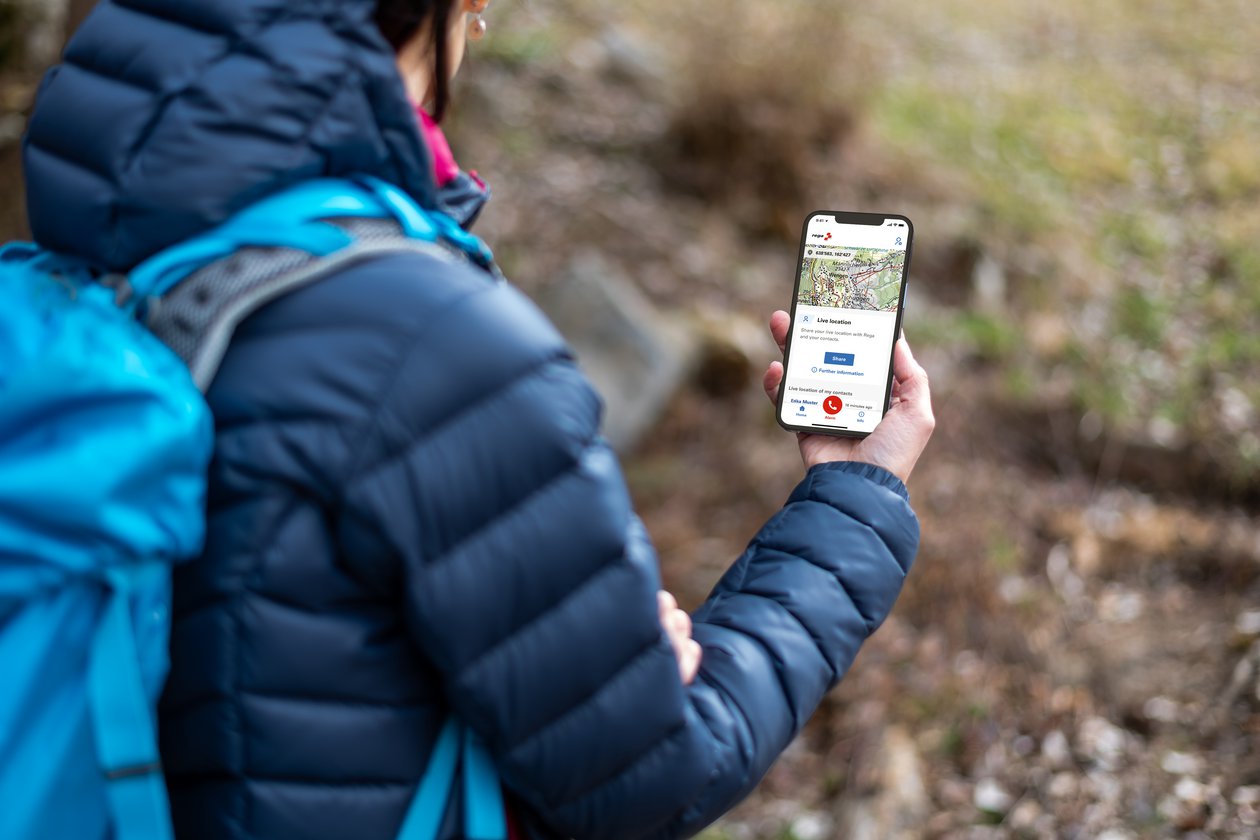
If you are in possession of a smartphone, it is worthwhile downloading Rega's free mobile application:
In the case of emergency, besides calling out a rescue helicopter, the emergency app also automatically transmits the coordinates of the caller and then sets up a telephone connection with Rega's Operation Center. After speaking to the person who has raised the alarm, Rega initiates the rescue. In order for the Location Services function of the app to work, the GPS signal needs to be enabled on the phone settings. And particularly important: the smartphone requires an adequate mobile phone reception.
In addition, the app features a map function that displays the caller's current position, or calculates the coordinates of any location on the map, and shows this data in various formats.


